


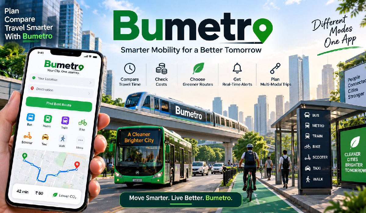
City travel can become complicated when a single journey depends on several types of transport. A person may walk to a bus stop, take a bus to a metro station, use a train for the longest part of the journey, and then walk or cycle to the final destination. Managing every stage separately can require different maps, schedules, apps, and payment systems. Bumetro is designed around the idea of making this process easier by bringing urban travel choices into a more connected experience.
The platform follows the broader concept of Mobility as a Service, commonly called MaaS. Instead of viewing buses, trains, bicycles, scooters, walking, and shared rides as completely separate services, MaaS organizes them around one complete journey. This approach can make complicated routes easier to understand.
Bumetro therefore represents more than basic directions between two locations. Its purpose is to help travelers examine different ways of reaching a destination while considering journey time, transportation type, possible costs, transfers, and available travel information.
What Is Bumetro?
Bumetro is a smart urban mobility platform built around connected journey planning. Its main idea is to help people find routes that may involve more than one transportation method. Rather than limiting a search to buses, trains, cars, or walking, a multimodal platform can consider several travel choices and organize them into a complete route from the starting point to the destination.
This approach is particularly useful in cities where transportation networks are large and varied. A commuter may have access to buses, metro lines, local trains, bicycles, scooters, taxis, shared vehicles, and walking routes. Looking at each option separately can make journey planning unnecessarily difficult.
Bumetro aims to simplify that process by giving travelers a clearer view of available choices. The exact information and functions available can depend on local transportation systems, data providers, and service integrations. For this reason, the experience may not be identical in every supported location.
Understanding Mobility as a Service
Mobility as a Service is a transportation model that puts the traveler at the center of journey planning. Traditional transportation systems often require passengers to deal separately with different operators. Someone might check a bus timetable first, open another service for train information, and then use a third platform to find a bicycle or ride for the final part.
Bumetro follows the MaaS idea by treating these individual stages as parts of one journey. A digital mobility platform can collect relevant transportation information and use it to present routes that combine available modes. This creates a more connected way to understand urban transportation.
The important feature of MaaS is not simply having several transport choices listed in one place. The real value comes from showing how those choices connect. A useful system considers departure points, arrival points, transfers, walking sections, journey duration, and other practical information required to complete the entire trip.
How Bumetro Can Plan a Complete Journey
A journey with Bumetro begins with a starting location and destination. The traveler provides these points, and the platform can examine transportation options that connect them. Instead of returning only one type of route, a multimodal journey planner can present different combinations based on the transport services and data available in that particular area.
For example, a traveler might walk ten minutes to a bus stop, take a bus to a metro station, travel several stops by metro, and walk from the final station to an office. Another possible route might replace the first bus with a bicycle. These alternatives can be organized into clear stages.
This complete-journey approach helps users understand the route before leaving. Travelers can see where transportation changes are required and how different stages connect. It is especially useful for unfamiliar routes because users do not have to independently work out every transfer involved in reaching their destination.
Multi-Modal Route Planning
Multimodal planning is one of the main ideas behind Bumetro. The term means using two or more transportation modes during one journey. Modern cities often require this approach because a single bus, train, or metro line rarely connects every possible starting point directly with every destination. Combining services can fill these gaps more efficiently.
A multimodal route might include walking, a shared bicycle, metro travel, and another short walk. Another journey could combine a bus with commuter rail. The platform can organize these stages in the order they are needed, allowing the traveler to understand how the complete route works rather than searching for each section individually.
Different combinations can also serve different needs. One traveler may prioritize the shortest journey time, while another wants fewer transfers. Someone else may prefer a cheaper route or less walking. Showing multiple practical alternatives allows travelers to choose according to their own circumstances rather than assuming one route suits everyone.
Public Transportation and Bumetro
Public transportation forms an important part of the Bumetro concept because buses, metros, trams, and local trains carry large numbers of people through urban areas. A connected journey planner can organize information about these services and show where they fit within a complete trip. This is particularly helpful when passengers must transfer between different lines or transport types.
Useful public transport information may include stops, stations, departure schedules, expected journey duration, service hours, and transfer points. When real-time information is available from an operator, travelers may also receive more current details about vehicle arrivals or disruptions. The amount of information depends on what local transportation providers make available.
This means Bumetro may work differently across locations. One city could provide detailed live information for buses and trains, while another may offer mainly scheduled timetable data. The quality of route planning therefore depends partly on the transportation infrastructure, operators, and digital data systems available locally.
Bikes, Scooters, Walking, and Last-Mile Travel
Public transportation does not always begin outside a person’s home or end directly beside the final destination. The distance between a traveler and the nearest useful station is commonly described as a first-mile or last-mile problem. Bumetro can address this part of journey planning by considering smaller transportation options alongside larger public transit networks.
Walking is often the simplest connection. In other situations, bicycles, shared bikes, e-bikes, or electric scooters may provide a faster link to a station. A journey planner can potentially show how these options connect with buses, metros, trams, or trains when relevant local information is available.
These short stages can have a major effect on the usefulness of a route. A railway journey might appear convenient until a traveler discovers that the station is difficult to reach. Including walking distances, nearby mobility services, pickup locations, and station connections creates a more realistic picture of the complete journey rather than focusing only on its longest section.
Real-Time Travel Information and Alerts
Urban transportation can change quickly. Traffic congestion may delay a bus, technical problems may affect a metro line, and construction work may move a stop to another street. Weather conditions, special events, road closures, and service interruptions can also affect a planned journey. Real-time information can therefore be an important part of a platform such as Bumetro.
When live transportation data is available, the platform can use it to provide more current information about a journey. A traveler may discover that a planned service is delayed or that another route could avoid a disruption. Receiving this information before reaching a station can reduce unnecessary waiting and make changing plans easier.
However, real-time information depends on external data. Transportation operators do not all provide the same level of live coverage or accuracy. Some systems track vehicles closely, while others mainly publish scheduled times. Travelers should therefore understand that arrival estimates can change as conditions develop during a journey.
Comparing Travel Time and Convenience
The fastest journey is not automatically the most practical one. A route that saves ten minutes could involve several difficult transfers, while a slightly longer journey might use one direct train. Bumetro can make route planning more useful by allowing different aspects of a journey to be considered together instead of focusing only on total travel time.
Important factors can include estimated duration, departure time, arrival time, walking distance, waiting periods, transportation changes, and the number of transfers. These details help users understand what a route will actually involve. They are particularly valuable for travelers carrying luggage, visiting an unfamiliar city, or trying to reach an appointment at a specific time.
Convenience also depends on personal circumstances. Some users may prefer minimal walking, while others are comfortable walking farther to avoid an additional bus. By presenting useful route information clearly, a multimodal system allows the traveler to decide which combination is appropriate for the individual journey.
Understanding Travel Costs
Price can be just as important as travel time when choosing transportation. Bus fares, metro tickets, railway prices, bike rentals, scooter charges, and on-demand rides can all affect the total cost of a journey. Bumetro can make comparison easier when relevant pricing information is available for the transportation services included in a proposed route.
A cheaper journey may require more walking or take longer. A faster option may include a paid ride service that increases the overall cost. Seeing expected costs beside different routes can help users understand these trade-offs before starting their journey. This is particularly useful for regular commuters who need to control weekly or monthly transportation spending.
Actual prices can still depend on local fare rules. Cities may use travel zones, peak pricing, day passes, subscriptions, transfer discounts, or separate operator fares. Shared mobility prices can also change according to duration or demand. Travelers should therefore check applicable fare conditions when accurate budgeting is important.
Tickets, Payments, and Local Transport Rules
Journey planning and ticket purchasing are separate functions. Bumetro may help users understand available transportation routes, but integrated ticket or payment functions can depend on agreements with local transit authorities and private mobility companies. A feature offered in one location should not automatically be assumed to exist in every city or transportation network.
Where payment integration is supported, digital tools can make a multimodal journey more convenient by reducing the need to use separate systems. However, some transport operators may still require their own tickets, travel cards, applications, or payment methods. Local fare zones and validation requirements can also affect how passengers travel.
Users should check transportation rules before beginning an unfamiliar journey. This includes ticket validity, service hours, fare zones, transfer conditions, bicycle rental requirements, and any restrictions affecting shared mobility. Understanding these details is especially important for visitors because local ticketing systems can differ significantly between cities, even when the transportation modes themselves appear similar.
Eco-Impact and Sustainable Travel Choices
Urban transportation has environmental effects that vary according to the type of journey. Walking and cycling require no direct vehicle fuel, while buses and rail systems can move many passengers at the same time. Private cars and on-demand vehicles have different impacts depending on distance, vehicle technology, occupancy, traffic conditions, and energy source. Bumetro can help place environmental considerations alongside other route factors.
Where environmental comparisons are available, travelers may be able to examine a route’s estimated impact before choosing it. For example, a public transportation and walking combination may be compared with a journey that relies more heavily on a private vehicle. This information can make sustainable travel choices easier to understand.
Environmental impact should still be viewed as an estimate rather than a simple universal score. Electricity sources, vehicle efficiency, passenger numbers, and local infrastructure all matter. The main benefit is giving travelers another useful factor to consider alongside time, price, walking distance, and convenience.
Benefits of Bumetro for Daily Commuters
Regular commuters often repeat similar journeys several times each week, so small improvements in planning can make a meaningful difference. Bumetro can provide a more organized view of transportation choices by bringing different stages of a city journey together. Users can examine possible routes, transfers, travel times, and available transport modes before deciding how to travel.
Another benefit is discovering alternatives. A commuter who normally uses one direct bus might find that a bus-and-metro combination takes less time. Someone facing a disrupted railway line may find another public transport connection. Multimodal information gives users more choices when their usual journey is unavailable or inconvenient.
The platform can also reduce the effort required to understand complicated journeys. Instead of manually comparing several transportation services, travelers can view connected options more clearly. The greatest practical benefit comes from information and organization: the underlying buses, trains, roads, and mobility services remain responsible for actually delivering each part of the journey.
How Bumetro Can Help City Visitors
Traveling through an unfamiliar city can be harder than completing a regular commute. Visitors may not recognize station names, understand local bus numbers, know which metro line to use, or realize how far they must walk between connections. Bumetro can make unfamiliar transportation easier to understand by organizing the journey into a clear sequence.
A visitor can benefit from seeing where to begin, which transportation mode comes next, where a transfer occurs, and how the final section of the journey should be completed. Walking stages are particularly important because major transport stations may have several entrances or connect with nearby stops in ways that are not immediately obvious.
Visitors should still pay attention to local conditions. Operating hours may change at weekends, ticket rules may differ between services, and temporary disruptions can affect planned routes. Using connected journey information together with current local transport notices gives travelers a clearer and more practical way to navigate unfamiliar urban areas.
How Cities Can Benefit From Connected Mobility
The benefits of Bumetro are not limited to individual passengers. Connected mobility platforms can make existing transportation networks easier for residents and visitors to understand. When people can clearly see how buses, trains, walking routes, bicycles, and other services connect, they may be better able to use transportation options that already exist within a city.
Integrated mobility information can also highlight connections that passengers might otherwise overlook. A bicycle link to a railway station, for example, may make rail travel practical for someone living beyond comfortable walking distance. Better information about transfers can similarly make public transportation easier to use for complex journeys.
Digital platforms alone cannot solve transportation problems. They cannot create new railway lines, increase bus frequency, remove road congestion, or repair infrastructure. Those improvements require investment, planning, staff, and public policy. The role of a mobility platform is primarily to help users understand and navigate the transportation network that is available to them.
Privacy, Location Data, and Security
Location information is useful for journey planning because a service needs to understand where a traveler is starting and where nearby transportation options are located. Bumetro users should therefore understand how location permissions and other personal information may relate to mobility features. The exact data collected depends on the functions and policies of the service being used.
Travel applications may potentially handle location information, saved destinations, journey history, account details, and payment information when related features are available. Users should review privacy information before providing sensitive details. They should also examine which permissions are requested and whether those permissions are necessary for the features they want to use.
Basic digital safety remains important. Travelers should use official services, protect account credentials, keep applications updated, and use secure payment methods where transactions are supported. Location permissions can also be limited when continuous access is unnecessary. These steps give users greater control over their personal information while using mobility technology.
Bumetro Availability and Local Differences
The usefulness of Bumetro can depend strongly on where it is being used. Transportation networks are not standardized across cities. One location may have extensive metro lines, live bus tracking, shared bicycles, scooters, and detailed open transport data. Another city may operate a smaller network with fewer digital services and less real-time information.
Local partnerships can also influence what users can access. Transportation operators and private mobility companies control much of the route, pricing, vehicle, and service information required by multimodal platforms. Ticketing and payment integration may require additional agreements and technical systems. As a result, feature availability can vary even when the general journey-planning concept remains the same.
Users should check current local coverage before depending on the platform for an important journey. They should confirm which transportation modes are supported, whether information is live or timetable-based, and whether tickets must be purchased separately. Local verification provides a more accurate understanding of what the service can offer.
Challenges and Limitations of Bumetro
No journey-planning platform can guarantee that every suggested trip will happen exactly as displayed. Bumetro depends on transportation information, maps, schedules, location technology, and data supplied by outside services. If one source is incomplete or delayed, the journey information shown to users may also be affected.
Unexpected events create another limitation. A bus can become trapped in traffic after a route has been calculated. A train may experience a technical problem, or a bicycle shown at a sharing station could be taken by another customer. GPS signals can also become less accurate around tall buildings, underground stations, tunnels, and other difficult locations.
These limitations do not remove the usefulness of connected journey planning, but they show why travelers should remain attentive. Important journeys may require additional time for unexpected delays. During major disruptions, users should also check notices from relevant transport operators because those organizations control the actual services and can provide operational instructions.
The Future of Bumetro and Smart City Travel
Urban mobility is becoming increasingly connected as transportation operators adopt digital schedules, vehicle tracking, electronic payments, and shared data systems. Bumetro fits into this wider development by focusing on journeys that can cross several transportation modes. Better integration could make future multimodal travel easier to understand and manage.
Across the mobility sector, technologies such as more accurate real-time information, accessibility data, integrated payments, predictive journey planning, and personalized route preferences are continuing to develop. These technologies could allow mobility platforms to provide more useful information about delays, connections, travel costs, walking requirements, and available transportation choices. Their implementation will still depend on local infrastructure and partnerships.
The long-term success of connected urban mobility also depends on simplicity. Travelers need accurate information presented in a form they can understand quickly. Technology is most useful when it removes unnecessary complexity while allowing people to choose transportation according to their own priorities.
Final Thoughts
Bumetro can be understood as part of the movement toward more connected and user-focused urban transportation. Instead of treating a bus, train, bicycle, scooter, shared ride, and walking route as unrelated services, the Mobility as a Service approach attempts to organize them around the complete journey a traveler needs to make.
This approach can help users compare transportation modes, understand transfers, examine travel time, consider costs, respond to available service information, and solve first-mile or last-mile connections. Its practical usefulness depends on local transport networks, the quality of available data, supported mobility providers, and the level of integration offered within each city.
Bumetro does not replace the transportation network itself. Its role is to make that network easier to understand and navigate. For commuters and visitors dealing with increasingly complex urban travel choices, connected journey planning can provide a simpler way to evaluate how to move from one place to another.
(FAQs)
What is Bumetro?
Bumetro is a smart urban mobility platform designed around connected city travel. It helps users understand routes that may combine public transport, walking, cycling, scooters, and other available transportation options.
How does Bumetro work?
Bumetro uses the Mobility as a Service approach to organize different transport modes into one journey. Users can compare routes based on factors such as travel time, transfers, cost, and convenience.
Can Bumetro provide real-time travel information?
Bumetro may provide real-time information when local transportation operators make suitable data available. This information can include delays, arrival updates, disruptions, and changes that could affect a planned journey.
Does Bumetro support buses, trains, bikes, and scooters?
Bumetro is based on multimodal transportation and can bring different travel modes into journey planning. Supported services may include buses, metro systems, trains, walking, bikes, scooters, and shared mobility depending on local availability.
Is Bumetro available in every city?
Bumetro’s features and transportation coverage can vary by location. Availability depends on local transport networks, mobility providers, data access, partnerships, and the digital systems used by individual cities.
